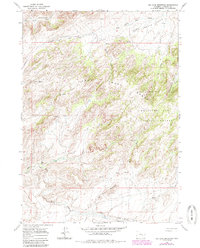
1960 Map of Ice Cave Mountain
USGS Topo · Published 1985About this map
Ice Cave Mountain dominates the southern landscape of this 1960s-era survey, which captures a high-elevation interior portion of the Medicine Bow National Forest. The map documents a rugged terrain characterized by the Deer Creek Range and a dense network of drainages including Smith Creek, West Fork Deer Creek, and Andys Creek. While largely unpopulated, the presence of Miles Cabin and several clusters of ruins suggest a history of seasonal habitation or early ranching efforts within these peaks.
Find a feature on this map
18 named features on this map. Tap any name to fly to it.
Don’t see what you’re looking for? This feature index may not catch every label — zoom into the map to look around manually.
Map Details
Editions of this 1960 Ice Cave Mountain Map
3 editions found
Other maps of this area

1955 · Casper
USGS Topo · 1:250,000

1958 · Casper
USGS Topo · 1:250,000

1959 · Squaw Spring
USGS Topo · 1:24,000

1959 · Bates Creek Reservoir
USGS Topo · 1:24,000

1960 · Crimson Dawn
USGS Topo · 1:24,000

1960 · Sheep Creek
USGS Topo · 1:24,000

1960 · Mud Springs
USGS Topo · 1:24,000

1960 · Ice Cave Mountain
USGS Topo · 1:24,000

1960 · Banner Mtn
USGS Topo · 1:24,000
1960 · Otter Creek
USGS Topo · 1:24,000