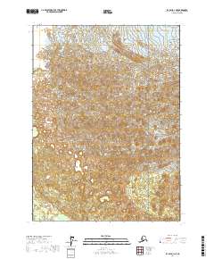
2017 Map of Icy Bay D-1 NE
USGS Topo · Published 2017About this map
Agassiz Glacier dominates the northern reaches of this glacial landscape within the Wrangell-Saint Elias National Park. The topography is defined by the massive movement of ice and the resulting drainage patterns across the terrain. This 2017 survey shows the intricate details of the glacial front and its interaction with the surrounding environment in the Yakutat City and Borough. The grid lines for t22s r25e, t22s r26e, t23s r25e, and t23s r26e provide a precise spatial framework for studying this dynamic wilderness area, where the ice and mountains meet the coastal region of Alaska.
Find a feature on this map
6 named features on this map. Tap any name to fly to it.
Don’t see what you’re looking for? This feature index may not catch every label — zoom into the map to look around manually.
Map Details
Editions of this 2017 Icy Bay D-1 NE Map
This is the sole edition of this map. No revisions or reprints were ever made.
Other maps of this area

1950 · Bering Glacier
USGS Topo · 1:250,000

1950 · Icy Bay
USGS Topo · 1:250,000

1951 · Icy Bay
USGS Topo · 1:250,000

1951 · Bering Glacier
USGS Topo · 1:250,000

1951 · Yakutat
USGS Topo · 1:250,000

1951 · Mt Saint Elias
USGS Topo · 1:250,000

1959 · Yakutat
USGS Topo · 1:250,000

1959 · Bering Glacier
USGS Topo · 1:250,000

1959 · Mt Saint Elias
USGS Topo · 1:250,000

1961 · Icy Bay
USGS Topo · 1:250,000