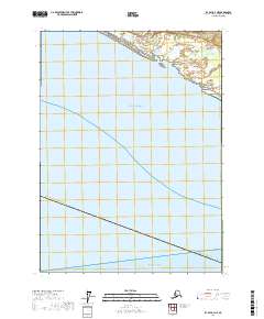
2017 Map of Icy Bay D-3 NE
USGS Topo · Published 2017About this map
Gulf of Alaska waters dominate this coastal survey of the Yakutat Borough, where the maritime boundary transitions into the open Pacific Ocean. Along the northern shoreline, a series of coastal drainages including Big River, Big Sandy Cr, and Little River empty into the sea across a landscape shaped by shifting alluvial deposits. The map captures a moment in the modern era when the hydrography of Lydick Cr and its neighbors define the interface between the borough's wetlands and the expansive gulf. This 2017 edition emphasizes the hydrological network of a sparsely settled reach of the Alaskan coast, providing a clear record of the river mouths and coastal contours as they existed at the time of the SPOT imagery acquisition in 2012.
Find a feature on this map
11 named features on this map. Tap any name to fly to it.
Don’t see what you’re looking for? This feature index may not catch every label — zoom into the map to look around manually.
Map Details
Editions of this 2017 Icy Bay D-3 NE Map
This is the sole edition of this map. No revisions or reprints were ever made.
Other maps of this area

1948 · Icy Bay D-2 and D-3
USGS Topo · 1:63,360

1950 · Bering Glacier A-3
USGS Topo · 1:63,360

1950 · Bering Glacier
USGS Topo · 1:250,000

1950 · Icy Bay
USGS Topo · 1:250,000

1951 · Icy Bay D-2 and D-3
USGS Topo · 1:63,360

1951 · Icy Bay
USGS Topo · 1:250,000

1951 · Bering Glacier
USGS Topo · 1:250,000

1951 · Bering Glacier A-2
USGS Topo · 1:63,360
1959 · Icy Bay D-2 and D-3
USGS Topo · 1:63,360

1959 · Bering Glacier
USGS Topo · 1:250,000