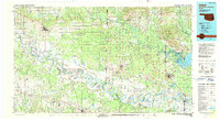
1990 Map of Idabel
USGS Topo · Published 1990About this map
The Red River and Little River define the winding geography of this tri-state border region, where the wooded uplands of the Ouachita National Forest meet the fertile bottomlands of the Gulf Coastal Plain. At this time in the 1990s, the landscape is a complex network of oxbow lakes and sloughs, including Grassy Lake, Old River Lake, and Victor Lake, illustrating the historical movement of the river channels across the Oklahoma, Arkansas, and Texas borders.
Find a feature on this map
100 named features on this map. Tap any name to fly to it.
Don’t see what you’re looking for? This feature index may not catch every label — zoom into the map to look around manually.
Map Details
Editions of this 1990 Idabel Map
This is the sole edition of this map. No revisions or reprints were ever made.
Other maps of this area

1901 · Alikchi
USGS Topo · 1:125,000

1902 · Lukfata
USGS Topo · 1:125,000

1906 · Caddo Gap
USGS Topo · 1:125,000

1909 · New Boston
USGS Topo · 1:62,500

1909 · Texarkana
USGS Topo · 1:62,500

1913 · De Queen
USGS Topo · 1:125,000

1930 · Bassett
USGS Topo · 1:62,500

1950 · Mcalester
USGS Topo · 1:250,000

1950 · Redbank
USGS Topo · 1:24,000

1950 · Ashdown East
USGS Topo · 1:24,000