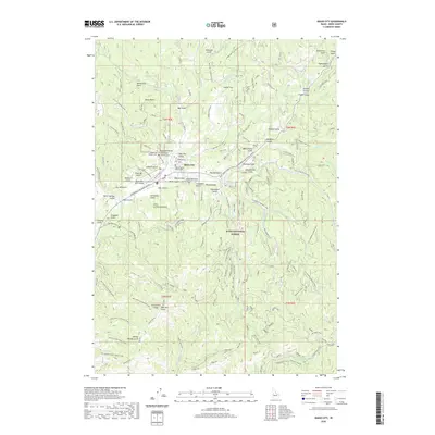
2020 Map of Idaho City
USGS Topo · Published 2020About this map
Idaho City sits at the heart of the Boise Basin, a landscape defined by its long history of mining and forestry. The town's layout is anchored by the Boise County Courthouse and serves as a gateway to the Boise National Forest. Early settlement patterns are clearly visible in the presence of the Idaho City Pioneer Cem and the Old Gulch Pioneer Cem, alongside evocative place names like Boot Hill. The intricate network of waterways, including Mores Cr and Elk Cr, is augmented by historical water management features such as the Franer Canal and Mine Ditch, which speak to the area's industrial past. Numerous gulches like Charcoal Gulch and California Gulch radiate from the central valley, following the deep drainages that once drew prospectors to this mountainous region.
Find a feature on this map
84 named features on this map. Tap any name to fly to it.
Don’t see what you’re looking for? This feature index may not catch every label — zoom into the map to look around manually.
Map Details
Editions of this 2020 Idaho City Map
This is the sole edition of this map. No revisions or reprints were ever made.
Other maps of this area

1894 · Idaho Basin
USGS Topo · 1:125,000

1955 · Hailey
USGS Topo · 1:250,000

1957 · Placerville
USGS Topo · 1:24,000

1957 · Pioneerville
USGS Topo · 1:24,000

1957 · Warm Springs Point
USGS Topo · 1:24,000

1957 · Idaho City
USGS Topo · 1:24,000

1959 · Hailey
USGS Topo · 1:250,000

1962 · Hailey
USGS Topo · 1:250,000

1964 · Twin Springs
USGS Topo · 1:24,000

1969 · Dunnigan Creek
USGS Topo · 1:24,000