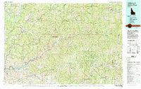
1982 Map of Idaho City
USGS Topo · Published 1982About this map
Idaho City serves as the focal point for this 1982 study of the Boise Basin, an area defined by its legacy of gold mining and the complex drainage of the Boise River and its forks. The landscape is a network of historic mining districts, where sites like the Gold Hill Mine, Quartzburg Mine, and Belshazzar Mine reveal the intensive extractive history of the Boise Mountains. Small settlements such as Placerville, Centerville, and the isolated outpost of Atlanta are connected by forest roads and the high-elevation terrain of the Boise National Forest. To the southwest, the impounded waters of the Arrowrock Reservoir at Arrowrock Dam contrast with the primitive reaches of the Sawtooth Wilderness in the northeast. This map documents a region where recreational land use, including numerous sites like Paradise Hot Springs Campground, has overlaid a rugged geography of timber and mineral wealth.
Find a feature on this map
101 named features on this map. Tap any name to fly to it.
Don’t see what you’re looking for? This feature index may not catch every label — zoom into the map to look around manually.
Map Details
Editions of this 1982 Idaho City Map
This is the sole edition of this map. No revisions or reprints were ever made.
Other maps of this area

1891 · Bear Valley
USGS Topo · 1:125,000

1892 · Mountain Home
USGS Topo · 1:125,000

1892 · Boise
USGS Topo · 1:125,000

1892 · Bisuka
USGS Topo · 1:125,000

1892 · Camas Prairie
USGS Topo · 1:125,000

1893 · Mountain Home
USGS Topo · 1:125,000

1893 · Bear Valley
USGS Topo · 1:125,000

1893 · Camas Prairie
USGS Topo · 1:125,000

1894 · Bisuka
USGS Topo · 1:125,000

1894 · Squaw Creek
USGS Topo · 1:125,000