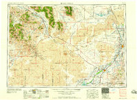
1958 Map of Idaho Falls
USGS Topo · Published 1958About this map
The Snake River corridor anchors this mid-century portrait of southeastern Idaho, where agricultural river valleys meet the stark volcanic geology of the Craters of the Moon National Monument. The map documents a period of significant infrastructure and expansion, showing the industrial nodes of Idaho Falls and Blackfoot alongside the Fort Hall Indian Reservation. To the north, the high peaks of the Challis National Forest and Pioneer Mountains loom over resource-rich basins, evidenced by the White Knob Mine and Copper Basin Mine near Mackay.
Find a feature on this map
124 named features on this map. Tap any name to fly to it.
Don’t see what you’re looking for? This feature index may not catch every label — zoom into the map to look around manually.
Map Details
Editions of this 1958 Idaho Falls Map
2 editions found

Other maps of this area

1895 · Hailey
USGS Topo · 1:125,000

1897 · Hailey
USGS Topo · 1:125,000

1917 · Portneuf
USGS Topo · 1:62,500

1918 · Paradise Valley
USGS Topo · 1:62,500

1924 · Ammon
USGS Topo · 1:62,500

1929 · Bayhorse
USGS Topo · 1:125,000

1934 · American Falls
USGS Topo · 1:62,500

1934 · Michaud
USGS Topo · 1:62,500

1935 · MacKay
USGS Topo · 1:96,000

1935 · Borah Peak
USGS Topo · 1:125,000