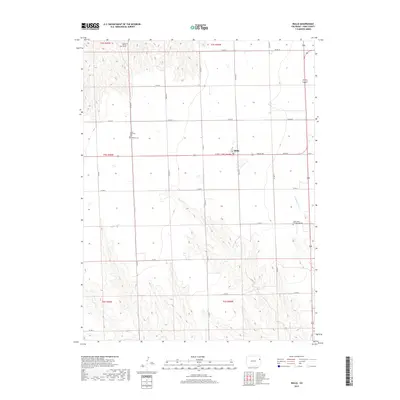
2019 Map of Idalia
USGS Topo · Published 2019About this map
The settlement of Idalia serves as the central hub of this eastern Colorado landscape, where the high plains are organized by a rigid grid of county roads. Local genealogy and history are anchored by several distinct burial sites across the township lines, including Mildred Cem, Lucas Memorial Cem, and the Saint Johns Evangelical Cem located further south. A particularly unique landmark, the Grave of Buffalo Hunter, sits near the northern boundary, offering a specific connection to the region's 19th-century frontier heritage. While much of the terrain is dedicated to agriculture, the drainage of Armknecht Cr introduces topographic variation in the southeast, breaking the regularity of the section lines and the primary thoroughfare of Wieser Ave.
Find a feature on this map
22 named features on this map. Tap any name to fly to it.
Don’t see what you’re looking for? This feature index may not catch every label — zoom into the map to look around manually.
Map Details
Editions of this 2019 Idalia Map
This is the sole edition of this map. No revisions or reprints were ever made.
Other maps of this area

1950 · Bonny Reservoir
USGS Topo · 1:62,500

1954 · Limon
USGS Topo · 1:250,000

1957 · Limon
USGS Topo · 1:250,000

1958 · Limon
USGS Topo · 1:250,000

1963 · Beecher Island
USGS Topo · 1:24,000

1963 · Wildcat Canyon
USGS Topo · 1:24,000

1968 · Vernon SW
USGS Topo · 1:24,000

1968 · Bonny Reservoir North
USGS Topo · 1:24,000

1968 · Spring Canyon
USGS Topo · 1:24,000

1968 · Idalia
USGS Topo · 1:24,000