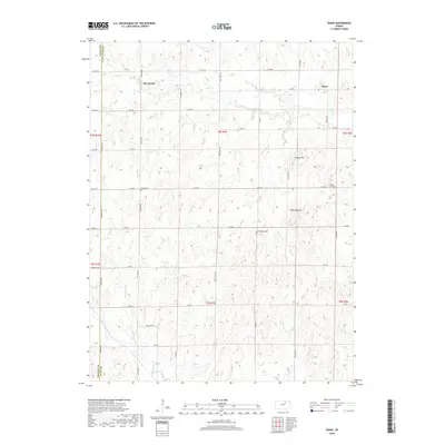
2018 Map of Idana
USGS Topo · Published 2018About this map
Idana sits as a central settlement on the high plains of Clay County, defined by a grid of rural roads and the undulating topography of the Kansas landscape. The area is marked by prominent natural landmarks such as Tobyne Hill, Table Mounds, and Potato Hill, which rise above the surrounding farmland and the drainage basins of Five Cr and Pinkerton Br. This 2018 survey reveals a terrain deeply tied to its agricultural roots, where the section lines of the Public Land Survey System dictate the placement of roads like Meridian Rd and Buffalo Rd.
Find a feature on this map
41 named features on this map. Tap any name to fly to it.
Don’t see what you’re looking for? This feature index may not catch every label — zoom into the map to look around manually.
Map Details
Editions of this 2018 Idana Map
This is the sole edition of this map. No revisions or reprints were ever made.
Other maps of this area

1891 · Clay Center
USGS Topo · 1:125,000

1955 · Manhattan
USGS Topo · 1:250,000

1956 · Manhattan
USGS Topo · 1:250,000

1957 · Manhattan
USGS Topo · 1:250,000
1964 · Industry
USGS Topo · 1:24,000

1964 · Clay Center NW
USGS Topo · 1:24,000

1964 · Clay Center SW
USGS Topo · 1:24,000

1964 · Idana
USGS Topo · 1:24,000

1964 · Miltonvale
USGS Topo · 1:24,000

1964 · Miltonvale NE
USGS Topo · 1:24,000