
1964 Map of Miltonvale
USGS Topo · Published 1966About this map
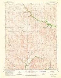
Miltonvale serves as the central hub of this mid-1960s survey, illustrating a well-established plains community where education and infrastructure intersect. The presence of Miltonvale Wesleyan College and the Miltonvale Cem reflects the town's social and historical roots, while the Atchison Topeka and Santa Fe railroad bisects the landscape, providing a critical link for the regional economy. The topography is defined by the winding course of Chapman Creek and its tributary, West Chapman Creek, which carve through the townships of Starr, Oakland, and Sherman. Outside the residential core, the map reveals industrial and utility markers including Gravel Pits and a Radio Tower, alongside the rural Mt Liberty Cem near the southern boundary. This record captures the transition of the Kansas prairie into a modern agricultural and collegiate landscape just before the late 20th century.
Find a feature on this map
17 named features on this map. Tap any name to fly to it.
Don’t see what you’re looking for? This feature index may not catch every label — zoom into the map to look around manually.
Map Details
Editions of this 1964 Miltonvale Map
This is the sole edition of this map. No revisions or reprints were ever made.
Other maps of this area

1891 · Clay Center
USGS Topo · 1:125,000

1892 · Minneapolis
USGS Topo · 1:125,000

1955 · Manhattan
USGS Topo · 1:250,000

1956 · Manhattan
USGS Topo · 1:250,000

1957 · Manhattan
USGS Topo · 1:250,000

1964 · Lamar
USGS Topo · 1:24,000

1964 · Idana
USGS Topo · 1:24,000

1964 · Miltonvale NE
USGS Topo · 1:24,000

1965 · Aurora
USGS Topo · 1:24,000
1965 · Manchester NW
USGS Topo · 1:24,000