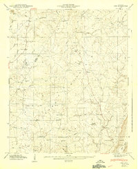
1947 Map of Ider
USGS Topo · Published 1947About this map
Ider sits atop the high plateau of Sand Mountain, serving as a central hub for a rural community defined by scattered crossroads and family-named landmarks just after the mid-1940s. This survey, conducted by the Tennessee Valley Authority, details a landscape of small farms and remote industries, including Yorks Mill and Old Bivins Mill located along the northern creeks. The settlement pattern is anchored by numerous country churches such as Macedonia Ch, Chestnut Grove Ch, and Mt Zion Ch, which often served as the social heart for nearby residents at Skaggs Corner and Beaty Crossroads. Moving south toward Troxtei Gap, the terrain descends into Sand Valley, where the transition from the mountain's flat top to the Little Ridge becomes more pronounced. Local genealogists will find value in the precise locations of the Fuller Cem and Biddle Cem, along with named intersections like Townsend Crossroads and Biddle Crossroads.
Find a feature on this map
54 named features on this map. Tap any name to fly to it.
Don’t see what you’re looking for? This feature index may not catch every label — zoom into the map to look around manually.
Map Details
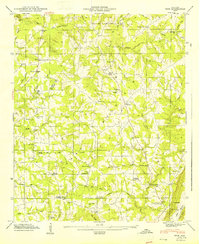
Editions of this 1947 Ider Map
2 editions found
Other maps of this area

1886 · Stevenson
USGS Topo · 1:125,000

1892 · Stevenson
USGS Topo · 1:125,000

1895 · Stevenson
USGS Topo · 1:125,000

1936 · Trenton
USGS Topo · 1:24,000

1936 · Ider
USGS Topo · 1:24,000

1936 · Flat Rock
USGS Topo · 1:24,000

1936 · Dugout Valley
USGS Topo · 1:24,000

1936 · Sulphur Springs
USGS Topo · 1:24,000

1936 · Sylvania
USGS Topo · 1:24,000

1936 · Stevenson
USGS Topo · 1:24,000