
1956 Map of Iditarod
USGS Topo · Published 1965About this map
The Iditarod River and its meandering tributaries dominate this interior landscape during a period of transition for the region's mining and military presence. Gold mining history is visible along Bonanza Creek and Otter Creek, where the settlements of Flat and Discovery persist near the Iditarod (Aband) site. The landscape reveals the shift from the early twentieth-century gold rush era to the Cold War, evidenced by the Takotna Air Force Station near Takotna. A network of tractor trails and footpaths connects these remote outposts, tracing routes through the Kuskokwim Mountains and the wetlands surrounding Dikeman (Site). This map captures the industrial character of the territory through labels for several placer mines and a lone Cem near the river, marking the human footprint in the vast wilderness of the Kuskokwim River basin.
Find a feature on this map
69 named features on this map. Tap any name to fly to it.
Don’t see what you’re looking for? This feature index may not catch every label — zoom into the map to look around manually.
Map Details
Editions of this 1956 Iditarod Map
3 editions found
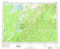
Other maps of this area

1947 · Russian Mission
USGS Topo · 1:250,000

1949 · McGrath
USGS Topo · 1:250,000

1950 · Medfra
USGS Topo · 1:250,000

1950 · Russian Mission
USGS Topo · 1:250,000

1950 · Sleetmute
USGS Topo · 1:250,000

1950 · McGrath
USGS Topo · 1:250,000

1951 · Ophir
USGS Topo · 1:250,000

1951 · Unalakleet
USGS Topo · 1:250,000

1951 · Holy Cross
USGS Topo · 1:250,000

1951 · Lime Hills
USGS Topo · 1:250,000