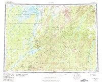
1956 Map of Iditarod
USGS Topo · Published 1984About this map
The Kuskokwim Mountains dominate the interior of this topographic study, where the legacy of the Alaska Gold Rush is visible through the concentration of settlements around the Iditarod River. The map documents the historic mining corridor between Iditarod and Flat, including the nearby locations of Discovery and Otter. These names recall the early 20th-century boom when the area served as a critical transshipment point for prospectors.
Find a feature on this map
51 named features on this map. Tap any name to fly to it.
Don’t see what you’re looking for? This feature index may not catch every label — zoom into the map to look around manually.
Map Details
Editions of this 1956 Iditarod Map
3 editions found

Other maps of this area

1947 · Russian Mission
USGS Topo · 1:250,000

1949 · McGrath
USGS Topo · 1:250,000

1950 · Medfra
USGS Topo · 1:250,000

1950 · Russian Mission
USGS Topo · 1:250,000

1950 · Sleetmute
USGS Topo · 1:250,000

1950 · McGrath
USGS Topo · 1:250,000

1951 · Ophir
USGS Topo · 1:250,000

1951 · Unalakleet
USGS Topo · 1:250,000

1951 · Holy Cross
USGS Topo · 1:250,000

1951 · Lime Hills
USGS Topo · 1:250,000