
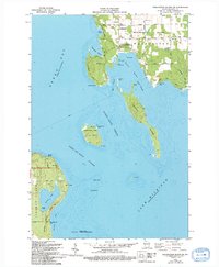
2022 Map of Idlewild
USGS Topo · Published 2022About this map
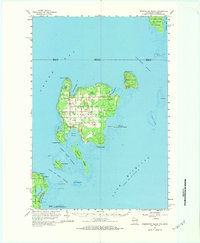
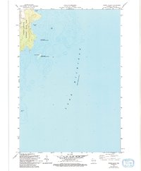
Idlewild sits at the northern tip of a peninsula where the waters of Sawyer Harbor meet the greater expanse of Green Bay. This coastal landscape is defined by its dramatic points and hazardous underwater features, such as Sherwood Point Shoal and Larsons Reef, which have long necessitated maritime caution. The map reveals a specialized coastal infrastructure, including a designated Water Trail that skirts the rocky shoreline near Sherwood Point and Cabot Point.
Find a feature on this map
36 named features on this map. Tap any name to fly to it.
Don’t see what you’re looking for? This feature index may not catch every label — zoom into the map to look around manually.
Map Details
Editions of this 2022 Idlewild Map
This is the sole edition of this map. No revisions or reprints were ever made.
Historical Maps of Idlewild Through Time
43 maps found

1960 Jacksonport
Door County, WI
1960 Washington Island
Door County, WI

1961 Chambers Island
Door County, WI

1978 Brussels
Door County, WI
1978 Namur
Door County, WI

1981 Idlewild
Door County, WI

1981 Institute
Door County, WI
1981 Sturgeon Bay East
Door County, WI

1981 Sturgeon Bay West
Door County, WI

1982 Algoma NE
Door County, WI

1982 Baileys Harbor East
Door County, WI

1982 Baileys Harbor West
Door County, WI
1982 Chambers Island
Door County, WI

1982 Green Island
Door County, WI

1982 Jacksonport
Door County, WI

1982 Jacksonport SW
Door County, WI

1982 Little Sturgeon SW
Door County, WI
1982 Spider Island
Door County, WI
1982 Washington Island NE
Door County, WI
1982 Washington Island NW
Door County, WI
1982 Washington Island SE
Door County, WI
1982 Washington Island SW
Door County, WI
1984 Washington Island
Door County, WI

2022 Algoma NE
Door County, WI

2022 Baileys Harbor East
Door County, WI

2022 Baileys Harbor West
Door County, WI

2022 Brussels
Door County, WI

2022 Chambers Island
Door County, WI

2022 Chambers Island NW
Door County, WI

2022 Green Island
Door County, WI
2022 Idlewild
Door County, WI

2022 Institute
Door County, WI

2022 Jacksonport
Door County, WI

2022 Jacksonport SW
Door County, WI

2022 Little Sturgeon SW
Door County, WI

2022 Namur
Door County, WI
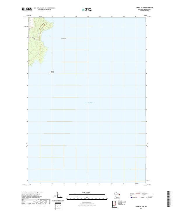
2022 Spider Island
Door County, WI

2022 Sturgeon Bay East
Door County, WI

2022 Sturgeon Bay West
Door County, WI

2022 Washington Island NE
Door County, WI

2022 Washington Island NW
Door County, WI

2022 Washington Island SE
Door County, WI

2022 Washington Island SW
Door County, WI