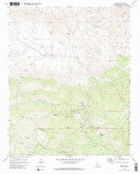
1969 Map of Idria
USGS Topo · Published 1980About this map
Idria sits at the heart of this mineral-rich landscape, where industrial mercury mining defined the local economy and geography for generations. The map reveals an extensive network of extraction sites, most notably the massive New Idria Mine and the San Carlos Mines further south near San Carlos Peak. These operations are supported by a complex infrastructure of jeep trails and the New Idria Road, which connects the settlement to outlying agricultural sites like Ashurst Ranch.
Find a feature on this map
44 named features on this map. Tap any name to fly to it.
Don’t see what you’re looking for? This feature index may not catch every label — zoom into the map to look around manually.
Map Details
Editions of this 1969 Idria Map
2 editions found
Other maps of this area

1913 · Panoche
USGS Topo · 1:125,000

1915 · Priest Valley
USGS Topo · 1:125,000

1923 · Monocline Ridge
USGS Topo · 1:31,680

1943 · New Idria
USGS Topo · 1:62,500

1943 · Hernandez Valley
USGS Topo · 1:62,500

1944 · Hernandez Valley
USGS Topo · 1:62,500

1944 · Panoche Valley
USGS Topo · 1:62,500

1948 · Santa Cruz
USGS Topo · 1:250,000

1955 · Santa Cruz
USGS Topo · 1:250,000
1955 · Monocline Ridge
USGS Topo · 1:24,000