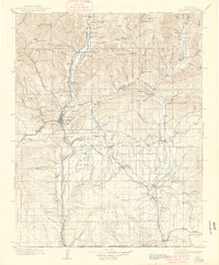
1908 Map of Ignacio
USGS Topo · Published 1939About this map
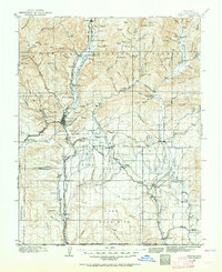
Durango and the surrounding high country are documented during a period of transition, following decades of survey work by Frank Tweedy and Gilbert Young. The Denver and Rio Grande RR serves as the primary artery for the region, threading through the Animas valley and connecting settlements like Bondad and Carbon Junc. The map captures the administrative and educational footprint of the era, from the Ute Indian Agency near Ignacio to rural outposts like Upper Florida Sch and the Grommet Oxford PO. This landscape is defined by the South Boundary Ute Ceded Land, which marks a significant historical partition of the terrain. Natural landmarks like Pinkerton Hot Springs and the Old Fish Hatchery reflect the early recreational and conservation efforts in the San Juan National Forest.
Find a feature on this map
112 named features on this map. Tap any name to fly to it.
Don’t see what you’re looking for? This feature index may not catch every label — zoom into the map to look around manually.
Map Details
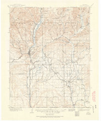
Editions of this 1908 Ignacio Map
3 editions found

Historical Maps of Durango Through Time
8 maps found