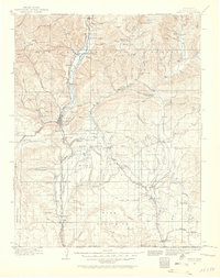
1924 Map of Ignacio
USGS Topo · Published 1958About this map
Durango serves as the focal point of this southwestern Colorado region, where the Animas River flows south toward the New Mexico border. The landscape is defined by the convergence of industrial and tribal histories, notably the Ute Indian Agency at Ignacio and the presence of the Rio Grande and Denver RR, which links settlements like Rockwood, Hermosa, and Carbon Junc. The map captures a transition from the high peaks of the San Juan National Forest to the high mesas of the south.
Find a feature on this map
112 named features on this map. Tap any name to fly to it.
Don’t see what you’re looking for? This feature index may not catch every label — zoom into the map to look around manually.
Map Details
Editions of this 1924 Ignacio Map
4 editions found

Other maps of this area

1889 · Largo
USGS Topo · 1:250,000

1889 · Chaco
USGS Topo · 1:250,000

1892 · Chaco
USGS Topo · 1:250,000

1895 · Largo
USGS Topo · 1:250,000

1895 · La Plata
USGS Topo · 1:62,500

1897 · La Plata
USGS Topo · 1:62,500

1897 · Rico
USGS Topo · 1:62,500

1898 · Durango
USGS Topo · 1:62,500

1898 · Engineer Mountain
USGS Topo · 1:62,500

1898 · Rico
USGS Topo · 1:62,500