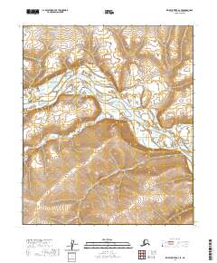
2020 Map of Ikpikpuk River A-3 SE
USGS Topo · Published 2020About this map
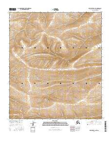
The Colville River dominates this Arctic landscape within the North Slope Borough, where the waterway carves a wide channel through the tundra. The river's path is marked by distinctive hydrological features such as Kakvuiyat Bend, where the current swings sharply against the surrounding bluffs. This 2020 topographical study captures the area's complex drainage network, including the confluence where Aupuk Cr feeds into the main river system. To the north, the terrain transitions into the upland features of Angoyakvik Pass, a notable geographical notch in the local relief. The map illustrates a remote wilderness defined by shifting watercourses and significant elevation changes, providing a clear record of the region's physical geography as it existed in the early 21st century.
Find a feature on this map
8 named features on this map. Tap any name to fly to it.
Don’t see what you’re looking for? This feature index may not catch every label — zoom into the map to look around manually.
Map Details
Editions of this 2020 Ikpikpuk River A-3 SE Map
This is the sole edition of this map. No revisions or reprints were ever made.
Other maps of this area

1951 · Ikpikpuk River
USGS Topo · 1:250,000

1951 · Killik River
USGS Topo · 1:250,000

1956 · Killik River
USGS Topo · 1:250,000

1956 · Ikpikpuk River
USGS Topo · 1:250,000
1984 · Killik River D-2
USGS Topo · 1:63,360

1984 · Ikpikpuk River A-3
USGS Topo · 1:63,360

1984 · Ikpikpuk River A-2
USGS Topo · 1:63,360
1986 · Killik River D-3
USGS Topo · 1:63,360
2016 · Killik River D-3 NW
USGS Topo · 1:25,000
2016 · Killik River D-3 NE
USGS Topo · 1:25,000