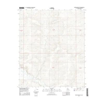
2016 Map of Ikpikpuk River B-2 SW
USGS Topo · Published 2016About this map
Maybe Creek winds through this expanse of the North Slope, serving as the primary drainage for a landscape defined by subtle topographic shifts and small tributary systems. The hydrology of the region is mapped in detail, showing the paths of Alice Cr in the northern reaches and Baby Cr further south. These named watercourses provide the only significant landmarks across the vast tundra, illustrating the drainage patterns that characterize this remote Arctic territory. The map's grid system, including t1s r9w and t2s r9w, establishes a precise framework over a region where natural features are sparse but essential for navigation and environmental monitoring. This 2016 survey reflects the modern geospatial documentation of Alaska's northern wilderness, emphasizing the importance of even the smallest named creeks in an otherwise uniform terrain.
Find a feature on this map
9 named features on this map. Tap any name to fly to it.
Don’t see what you’re looking for? This feature index may not catch every label — zoom into the map to look around manually.
Map Details
Editions of this 2016 Ikpikpuk River B-2 SW Map
This is the sole edition of this map. No revisions or reprints were ever made.
Other maps of this area

1951 · Ikpikpuk River
USGS Topo · 1:250,000

1956 · Ikpikpuk River
USGS Topo · 1:250,000

1984 · Ikpikpuk River A-3
USGS Topo · 1:63,360

1984 · Ikpikpuk River A-2
USGS Topo · 1:63,360

1985 · Ikpikpuk River B-3
USGS Topo · 1:63,360
1985 · Ikpikpuk River B-2
USGS Topo · 1:63,360
2013 · Ikpikpuk River B-2 SE
USGS Topo · 1:25,000
2015 · Ikpikpuk River B-2 NE
USGS Topo · 1:25,000
2016 · Ikpikpuk River B-2 NW
USGS Topo · 1:25,000
2016 · Ikpikpuk River B-3 SE
USGS Topo · 1:25,000