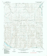
1985 Map of Ikpikpuk River B-2
USGS Topo · Published 1985About this map
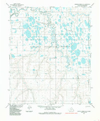
National Petroleum Reserve in Alaska dominates this 1985 topographic study of the North Slope, revealing a landscape defined by meandering watercourses and essential arctic transportation routes. The map documents the drainage patterns of several major tributaries, including Alice Creek in the north and the convergence of Anak Creek and Maybe Creek further south. These waterways carve through the tundra, providing natural navigation markers in a region with few permanent landmarks.
Find a feature on this map
14 named features on this map. Tap any name to fly to it.
Don’t see what you’re looking for? This feature index may not catch every label — zoom into the map to look around manually.
Map Details
Editions of this 1985 Ikpikpuk River B-2 Map
This is the sole edition of this map. No revisions or reprints were ever made.
Other maps of this area

1951 · Ikpikpuk River
USGS Topo · 1:250,000

1956 · Ikpikpuk River
USGS Topo · 1:250,000

1984 · Ikpikpuk River A-3
USGS Topo · 1:63,360
1984 · Ikpikpuk River A-1
USGS Topo · 1:63,360

1984 · Ikpikpuk River A-2
USGS Topo · 1:63,360
1985 · Ikpikpuk River C-1
USGS Topo · 1:63,360

1985 · Ikpikpuk River B-3
USGS Topo · 1:63,360
1985 · Ikpikpuk River C-2
USGS Topo · 1:63,360
1985 · Ikpikpuk River C-3
USGS Topo · 1:63,360
1985 · Ikpikpuk River B-1
USGS Topo · 1:63,360