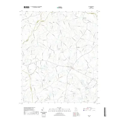
2020 Map of Ila
USGS Topo · Published 2020About this map
The S Fork Broad River winds through the heart of Madison County, framing a landscape defined by small crossroads settlements and family homesteads. The town of Ila serves as a central hub, where Commerce St meets Main St, while outlying communities like Pocataligo, Hix, and Fort Lamar maintain their distinct identities along the ridges and creek valleys. Numerous family and community burial grounds, such as Hix Cem, Culbertson Cem, and the Smith - Rogers Cem, are scattered across the quadrangle, reflecting generations of local ancestry. The mapping of the Hudson River and Masons Mill Cr illustrates the importance of these waterways in shaping the local geography. From the northern border with Banks and Franklin Counties to the reservoirs and lakes like Evans Lake and Minishs Lake, this 2020 survey documents the enduring rural character and road network of this Northeast Georgia region.
Find a feature on this map
154 named features on this map. Tap any name to fly to it.
Don’t see what you’re looking for? This feature index may not catch every label — zoom into the map to look around manually.
Map Details
Editions of this 2020 Ila Map
This is the sole edition of this map. No revisions or reprints were ever made.
Other maps of this area

1891 · Carnesville
USGS Topo · 1:125,000

1954 · Greenville
USGS Topo · 1:250,000

1958 · Greenville
USGS Topo · 1:250,000

1958 · Danielsville
USGS Topo · 1:62,500

1959 · Carnesville
USGS Topo · 1:24,000

1964 · Commerce
USGS Topo · 1:24,000

1964 · Ila
USGS Topo · 1:24,000

1964 · Ashland
USGS Topo · 1:24,000
1964 · Nicholson
USGS Topo · 1:24,000

1964 · Hull
USGS Topo · 1:24,000