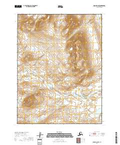
2018 Map of Iliamna A-4 NW
USGS Topo · Published 2018About this map
The Aleutian Range dominates this landscape on the Kenai Peninsula, where high-elevation topography meets a complex network of glacial and mountain streams. High peaks such as Mid Mtn overlook the drainages of the Paint River and the Lake Fork Paint River, which carve through the terrain as they flow toward the coast. The drainage patterns are further defined by smaller tributaries like Kenty Cr and Sulukpuk Creek, illustrating the remote and untouched hydrological system of this region in the early 21st century. This map captures the area before any significant human development, showing the transition from steep mountain slopes to the braided river valleys and wetlands that characterize the southwestern Alaskan wilderness.
Find a feature on this map
12 named features on this map. Tap any name to fly to it.
Don’t see what you’re looking for? This feature index may not catch every label — zoom into the map to look around manually.
Map Details
Editions of this 2018 Iliamna A-4 NW Map
This is the sole edition of this map. No revisions or reprints were ever made.
Other maps of this area

1951 · Iliamna A-5
USGS Topo · 1:63,360

1951 · Iliamna A-4
USGS Topo · 1:63,360

1951 · Iliamna B-5
USGS Topo · 1:63,360

1952 · Iliamna
USGS Topo · 1:250,000

1952 · Iliamna A-4
USGS Topo · 1:63,360

1952 · Iliamna A-5
USGS Topo · 1:63,360

1954 · Iliamna B-4
USGS Topo · 1:63,360
1954 · Iliamna B-5
USGS Topo · 1:63,360

1957 · Iliamna
USGS Topo · 1:250,000
2018 · Iliamna B-4 SW
USGS Topo · 1:25,000