
1954 Map of Iliamna B-4
USGS Topo · Published 1965About this map
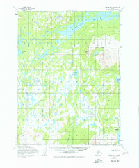
Kakhonak Lake dominates the northern landscape of this 1950s-era topographical record, its waters feeding into the Kakhonak River. This coastal Alaskan environment transitions from the deep waters of Kakhonak Bay in the northwest to the tidal reaches of Kamishak Bay and Bruin Bay along the eastern shoreline. The absence of roads or established settlements emphasizes a landscape defined by hydrology and terrain, from the Seven Sisters peaks to the isolated Venturi Lake. Waterways like Amakdedori Creek and Dunulktak Creek drain the interior, providing a detailed mapping of the drainage patterns and shoreline morphology before more modern development reached this part of the peninsula. Researchers will find the exact 1954 shoreline and terrain annotations provide a clear view of the area's natural state during the mid-century surveying period.
Find a feature on this map
10 named features on this map. Tap any name to fly to it.
Don’t see what you’re looking for? This feature index may not catch every label — zoom into the map to look around manually.
Map Details
Editions of this 1954 Iliamna B-4 Map
4 editions found
Other maps of this area

1951 · Iliamna A-5
USGS Topo · 1:63,360

1951 · Iliamna A-4
USGS Topo · 1:63,360

1951 · Iliamna B-5
USGS Topo · 1:63,360

1951 · Iliamna A-3
USGS Topo · 1:63,360

1952 · Iliamna
USGS Topo · 1:250,000

1952 · Iliamna A-4
USGS Topo · 1:63,360

1952 · Iliamna A-5
USGS Topo · 1:63,360

1954 · Iliamna C-5
USGS Topo · 1:63,360

1954 · Iliamna C-3
USGS Topo · 1:63,360

1954 · Iliamna B-3
USGS Topo · 1:63,360