
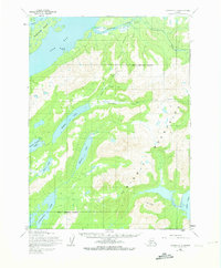
1954 Map of Iliamna C-3
USGS Topo · Published 1965About this map
Old Iliamna (Abandoned) sits along the northern reaches of the Iliamna River, serving as a silent indicator of shifting settlement patterns in this region of Alaska during the mid-1950s. The map illustrates a landscape shaped by water and elevation, where a Native Trail traverses the interior between Ptarmigan Creek and Chinkelyes Creek. To the west, the waters of Pedro Bay surround Porcupine Island, while the eastern side of the quadrangle descends toward Ursus Cove.
Find a feature on this map
20 named features on this map. Tap any name to fly to it.
Don’t see what you’re looking for? This feature index may not catch every label — zoom into the map to look around manually.
Map Details
Editions of this 1954 Iliamna C-3 Map
2 editions found
Other maps of this area

1952 · Iliamna
USGS Topo · 1:250,000

1954 · Iliamna D-3
USGS Topo · 1:63,360

1954 · Iliamna D-4
USGS Topo · 1:63,360

1954 · Iliamna B-3
USGS Topo · 1:63,360

1954 · Iliamna C-4
USGS Topo · 1:63,360

1954 · Iliamna B-4
USGS Topo · 1:63,360

1957 · Iliamna
USGS Topo · 1:250,000

1958 · Iliamna D-2
USGS Topo · 1:63,360

1958 · Iliamna C-2
USGS Topo · 1:63,360

1958 · Iliamna B-2
USGS Topo · 1:63,360