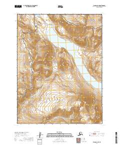
2019 Map of Iliamna A-6 SE
USGS Topo · Published 2019About this map
Katmai National Park and Katmai National Preserve meet in this 2019 survey, defining a wilderness landscape managed by the U.S. Department of the Interior. The dominant hydrological feature is the northern reach of Battle Lake, which extends through the eastern portion of the map, flanked by steep elevation contours that define the surrounding ridges. In the southwestern sector, Pfaff Peak stands as a prominent topographical landmark, its slopes drained by the headwaters of Nanuktuk Cr. The map illustrates the administrative transition between the park and preserve status, a distinction vital for understanding land use and resource management in this region of the Lake and Peninsula Borough. The absence of roads or established trails highlights the remote character of the territory during the early twenty-first century.
Find a feature on this map
9 named features on this map. Tap any name to fly to it.
Don’t see what you’re looking for? This feature index may not catch every label — zoom into the map to look around manually.
Map Details
Editions of this 2019 Iliamna A-6 SE Map
This is the sole edition of this map. No revisions or reprints were ever made.
Other maps of this area

1948 · Mt Katmai
USGS Topo · 1:250,000

1951 · Mt Katmai
USGS Topo · 1:250,000

1951 · Iliamna A-5
USGS Topo · 1:63,360

1951 · Mount Katmai D-4
USGS Topo · 1:63,360

1951 · Mount Katmai D-3
USGS Topo · 1:63,360

1951 · Iliamna A-6
USGS Topo · 1:63,360

1952 · Iliamna
USGS Topo · 1:250,000

1952 · Iliamna A-5
USGS Topo · 1:63,360

1957 · Iliamna
USGS Topo · 1:250,000

1964 · Mt. Katmai
USGS Topo · 1:250,000