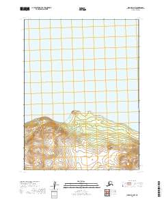
2019 Map of Iliamna B-6 NW
USGS Topo · Published 2019About this map
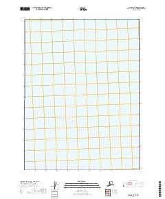
Iliamna Lake dominates the northern half of this landscape, its expansive waters meeting a coastline defined by prominent geological markers. The terrain transitions from the water's edge into a complex system of elevations, where Eagle Bluff stands as a significant coastal landmark near the center of the sheet. Further inland, the topography rises toward the distinct heights of Big Mtn in the southwest and the uniquely named Peters Plug to the east. This 2019 survey, produced by the U.S. Geological Survey, illustrates a wilderness area devoid of established roads or settlements, where the natural features and township boundaries like t9s r35w serve as the primary points of orientation for navigation and land management.
Find a feature on this map
8 named features on this map. Tap any name to fly to it.
Don’t see what you’re looking for? This feature index may not catch every label — zoom into the map to look around manually.
Map Details
Editions of this 2019 Iliamna B-6 NW Map
This is the sole edition of this map. No revisions or reprints were ever made.
Other maps of this area

1951 · Iliamna B-7
USGS Topo · 1:63,360

1951 · Iliamna B-6
USGS Topo · 1:63,360

1952 · Iliamna
USGS Topo · 1:250,000

1954 · Iliamna C-6
USGS Topo · 1:63,360
1954 · Iliamna B-6
USGS Topo · 1:63,360
1954 · Iliamna C-7
USGS Topo · 1:63,360

1957 · Iliamna
USGS Topo · 1:250,000
2019 · Iliamna B-7 NE
USGS Topo · 1:25,000
2019 · Iliamna C-7 SE
USGS Topo · 1:25,000
2019 · Iliamna B-7 SE
USGS Topo · 1:25,000