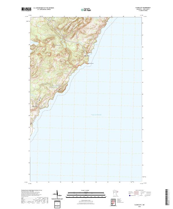
2022 Map of Illgen City
USGS Topo · Published 2022About this map
Lake Superior dominates the eastern horizon of this coastal survey, where the dramatic shoreline of Minnesota's North Shore is defined by prominent landmarks like Palisade Head and Shovel Point. The landscape rises sharply from the water into the Sawtooth Mountains, a terrain marked by the descent of the Baptism River and the hidden Illgen Falls. These topographical features created a challenging environment for early settlement, centering human activity around the coastal corridor of Old Hwy 61 and the established communities of Illgen City and Silver Bay.
Find a feature on this map
27 named features on this map. Tap any name to fly to it.
Don’t see what you’re looking for? This feature index may not catch every label — zoom into the map to look around manually.
Map Details
Editions of this 2022 Illgen City Map
This is the sole edition of this map. No revisions or reprints were ever made.
Other maps of this area

1954 · Silver Bay
USGS Topo · 1:62,500

1954 · Two Harbors
USGS Topo · 1:250,000

1956 · Little Marais
USGS Topo · 1:24,000

1956 · Finland
USGS Topo · 1:24,000

1956 · Finland
USGS Topo · 1:62,500

1956 · Illgen City
USGS Topo · 1:24,000

1956 · Split Rock Point
USGS Topo · 1:62,500

1956 · Split Rock Point NE
USGS Topo · 1:24,000

1957 · Two Harbors
USGS Topo · 1:250,000

1958 · Two Harbors
USGS Topo · 1:250,000