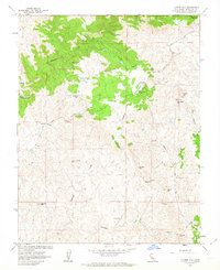
1962 Map of Illinois Hill
USGS Topo · Published 1963About this map
The gold-bearing foothills of Mariposa County are meticulously detailed here in the early 1960s, revealing an landscape defined by its mining heritage and cattle ranching terrain. The settlement of Ganns serves as a central point along White Rock Road, which winds through a territory marked by numerous mineral extractions. Hard-rock history is evident in the cluster of workings such as the Great Northern Mine, Pocahontas Mine, and the colorfully named Toad Mine.
Find a feature on this map
35 named features on this map. Tap any name to fly to it.
Don’t see what you’re looking for? This feature index may not catch every label — zoom into the map to look around manually.
Map Details
Editions of this 1962 Illinois Hill Map
3 editions found
Other maps of this area

1912 · Mariposa
USGS Topo · 1:125,000

1915 · Owens Creek
USGS Topo · 1:31,680

1918 · Owens Creek
USGS Topo · 1:31,680

1918 · La Grand
USGS Topo · 1:31,680

1919 · Indian Gulch
USGS Topo · 1:48,000

1919 · Raynor Creek
USGS Topo · 1:31,680

1920 · Indian Gulch
USGS Topo · 1:62,500

1942 · Raymond
USGS Topo · 1:62,500

1944 · Raymond
USGS Topo · 1:62,500
1946 · Le Grand
USGS Topo · 1:62,500