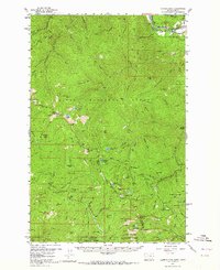
1957 Map of Illinois Peak
USGS Topo · Published 1964About this map
Mining operations and major rail lines define the divide between Montana and Idaho in this mid-century survey. The northern edge of the map is dominated by the Clark Fork valley, a critical transportation corridor carrying both the Chicago Milwaukee St Paul and Pacific and the Northern Pacific railroads. This infrastructure supported a landscape of extraction, evidenced by several named claims scattered across the steep drainages, including the Amador Mine, Golden Sunset Mine, and Gildersleeve Mine. The map reveals a complex administrative boundary where Lolo National Forest, St Joe National Forest, and Clearwater National Forest converge. High-altitude landmarks like Illinois Peak and Blacktail Mountain anchor the terrain, while small alpine waters such as Bonanza Lakes and Diamond Lake punctuate the high ridges of the Mineral and Shoshone county lines.
Find a feature on this map
93 named features on this map. Tap any name to fly to it.
Don’t see what you’re looking for? This feature index may not catch every label — zoom into the map to look around manually.
Map Details
Editions of this 1957 Illinois Peak Map
2 editions found
Other maps of this area

1911 · Lolo
USGS Topo · 1:250,000

1913 · Lolo
USGS Topo · 1:250,000

1918 · St Regis
USGS Topo · 1:125,000

1919 · St. Regis
USGS Topo · 1:125,000

1956 · St Regis
USGS Topo · 1:62,500

1956 · Wallace
USGS Topo · 1:250,000

1956 · Hamilton
USGS Topo · 1:250,000

1957 · Illinois Peak
USGS Topo · 1:62,500

1957 · Haugan
USGS Topo · 1:62,500

1957 · Simmons Peak
USGS Topo · 1:62,500