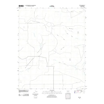
2010 Map of Ima
USGS Topo · Published 2010About this map
The high plains of eastern New Mexico define the landscape around the small settlement of Ima. Situated within the Alamogordo Valley, this area is characterized by a network of drainage systems and intermittent watercourses like Alamogordo Creek and Plaza Larga Creek. The topography transitions from the open expanses of Ogle Flat and the Mesa to deeply incised features such as Lobley Canyon and Taylor Canyon.
Find a feature on this map
23 named features on this map. Tap any name to fly to it.
Don’t see what you’re looking for? This feature index may not catch every label — zoom into the map to look around manually.
Map Details
Editions of this 2010 Ima Map
This is the sole edition of this map. No revisions or reprints were ever made.
Other maps of this area

1930 · Tucumcari
USGS Topo · 1:125,000

1954 · Santa Fe
USGS Topo · 1:250,000

1954 · Fort Sumner
USGS Topo · 1:250,000

1954 · Tucumcari
USGS Topo · 1:250,000

1954 · Clovis
USGS Topo · 1:250,000

1958 · Fort Sumner
USGS Topo · 1:250,000

1958 · Santa Fe
USGS Topo · 1:250,000

1958 · Clovis
USGS Topo · 1:250,000

1958 · Tucumcari
USGS Topo · 1:250,000

1964 · Gate Canyon
USGS Topo · 1:24,000