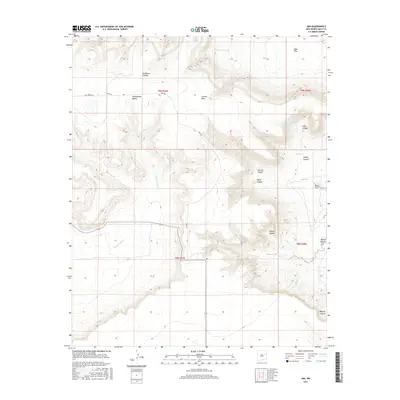
2017 Map of Ima
USGS Topo · Published 2017About this map
The small settlement of Ima serves as the central point in this part of eastern New Mexico, where the plains of the Llano Estacado meet complex drainage systems. The landscape is defined by the escarpments of Luciano Mesa and the broad Alamogordo Valley, which are dissected by numerous tributary canyons including Sunflower Canyon and Petes Canyon. Water sources are vital in this arid region, highlighted by Louisiana Spring and the winding courses of Plaza Larga Cr and Alamogordo Cr. The mapping reflects a traditional Western land use pattern of large open spaces like Ogle Flat and West Flat, interspersed with deep cuts such as Lobley Canyon and Bogard Canyon. Transport is minimal, primarily revolving around local routes like Quay Road 49.5, which provides access through this ranching and grazing country.
Find a feature on this map
25 named features on this map. Tap any name to fly to it.
Don’t see what you’re looking for? This feature index may not catch every label — zoom into the map to look around manually.
Map Details
Editions of this 2017 Ima Map
This is the sole edition of this map. No revisions or reprints were ever made.
Other maps of this area
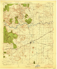
1930 · Tucumcari
USGS Topo · 1:125,000
1954 · Santa Fe
USGS Topo · 1:250,000

1954 · Fort Sumner
USGS Topo · 1:250,000
1954 · Tucumcari
USGS Topo · 1:250,000

1954 · Clovis
USGS Topo · 1:250,000

1958 · Fort Sumner
USGS Topo · 1:250,000
1958 · Santa Fe
USGS Topo · 1:250,000

1958 · Clovis
USGS Topo · 1:250,000
1958 · Tucumcari
USGS Topo · 1:250,000
1964 · Gate Canyon
USGS Topo · 1:24,000