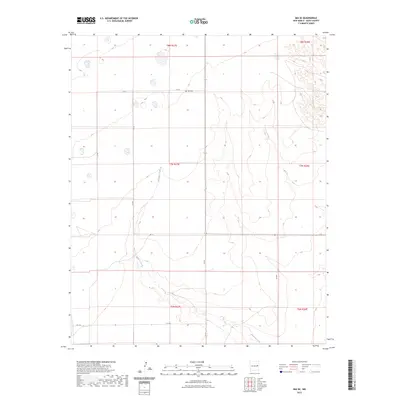
2023 Map of Ima SE
USGS Topo · Published 2023About this map
Ima Cem sits as a quiet landmark within this expansive rangeland of Quay County, offering a focal point for genealogical research in this sparsely populated region of eastern New Mexico. The landscape is defined by the winding course of Alamosa Creek, which cuts through the high plains terrain and dictates the local topography. This modern survey illustrates the enduring grid of the Public Land Survey System, showing the township and range divisions such as t7n r27e and t8n r27e. The road network consists primarily of local rural routes like Q R 41 and Q R 8h, which navigate the elevation changes and seasonal drainage patterns of the Llano Estacado's western fringes. The lack of dense settlement emphasizes the agricultural and pastoral nature of the area, where water sources and family burial grounds remain the most significant historical markers on the land.
Find a feature on this map
15 named features on this map. Tap any name to fly to it.
Don’t see what you’re looking for? This feature index may not catch every label — zoom into the map to look around manually.
Map Details
Editions of this 2023 Ima SE Map
This is the sole edition of this map. No revisions or reprints were ever made.
Other maps of this area

1954 · Fort Sumner
USGS Topo · 1:250,000

1954 · Clovis
USGS Topo · 1:250,000

1958 · Fort Sumner
USGS Topo · 1:250,000

1958 · Clovis
USGS Topo · 1:250,000

1968 · Hassell
USGS Topo · 1:24,000

1968 · Twin Mesa NW
USGS Topo · 1:24,000

1968 · Ima SE
USGS Topo · 1:24,000
1968 · Ima NW
USGS Topo · 1:24,000
1968 · Ima SW
USGS Topo · 1:24,000
1968 · Ima
USGS Topo · 1:24,000