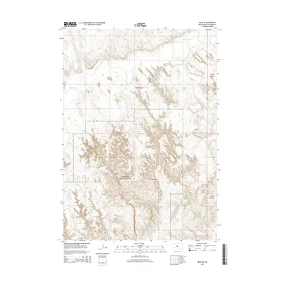
2015 Map of Imlay SE
USGS Topo · Published 2015About this map
Badlands National Park dominates the southern half of this South Dakota landscape, characterized by the intricate, erosion-carved topography typical of the region. The northern section transitions into a more riparian environment shaped by the meandering course of the White River, which is fed by several local drainages including Clifford Cr, Wind Cr, and Palmer Cr. The orientation of the land is defined by these watercourses as they cut through the high plains. In the northeast, Medicine Root Cr and Pass Creek converge toward the river valley, while River Rd provides one of the few named transportation corridors through the terrain. This map captures the stark boundary between the protected parklands and the surrounding township and range sections of Shannon County, revealing how natural hydrology dictates the movement and layout of the high prairie.
Find a feature on this map
12 named features on this map. Tap any name to fly to it.
Don’t see what you’re looking for? This feature index may not catch every label — zoom into the map to look around manually.
Map Details
Editions of this 2015 Imlay SE Map
This is the sole edition of this map. No revisions or reprints were ever made.
Other maps of this area

1950 · Conata
USGS Topo · 1:24,000

1950 · Conata SW
USGS Topo · 1:24,000

1950 · Imlay SW
USGS Topo · 1:24,000

1950 · Imlay
USGS Topo · 1:24,000

1950 · Imlay SE
USGS Topo · 1:24,000

1950 · Bouquet Table
USGS Topo · 1:24,000

1951 · Sharps Corner
USGS Topo · 1:24,000

1952 · Bouquet Table
USGS Topo · 1:24,000

1952 · Conata
USGS Topo · 1:24,000

1955 · Hot Springs
USGS Topo · 1:250,000