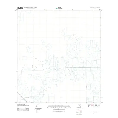
2012 Map of Immokalee NE
USGS Topo · Published 2012About this map
Agricultural irrigation and a rectilinear road network define this Collier County landscape as it appeared in the early 21st century. The map depicts a highly managed terrain where drainage and transit routes like Dupree Grade and Thorp Rd intersect vast, subdivided agricultural plots. This pattern reflects the region's intensive land use and water management systems, essential for farming in this part of Florida. Key transit arteries, including Co Hwy 846 and Co Rd 858, provide the primary structure for the area's development. The presence of Creek 846 in the southwest corner suggests the persistent influence of natural hydrology within an otherwise heavily engineered agricultural grid.
Find a feature on this map
6 named features on this map. Tap any name to fly to it.
Don’t see what you’re looking for? This feature index may not catch every label — zoom into the map to look around manually.
Map Details
Editions of this 2012 Immokalee NE Map
This is the sole edition of this map. No revisions or reprints were ever made.
Other maps of this area

1956 · West Palm Beach
USGS Topo · 1:250,000

1957 · West Palm Beach
USGS Topo · 1:250,000

1958 · West Palm Beach
USGS Topo · 1:250,000
1958 · Felda SE
USGS Topo · 1:24,000
1958 · Immokalee
USGS Topo · 1:24,000
1958 · Felda
USGS Topo · 1:24,000
1958 · Sunniland
USGS Topo · 1:24,000
1958 · Immokalee NE
USGS Topo · 1:24,000
1958 · Immokalee SW
USGS Topo · 1:24,000
1971 · La Belle 4 SW
USGS Topo · 1:24,000