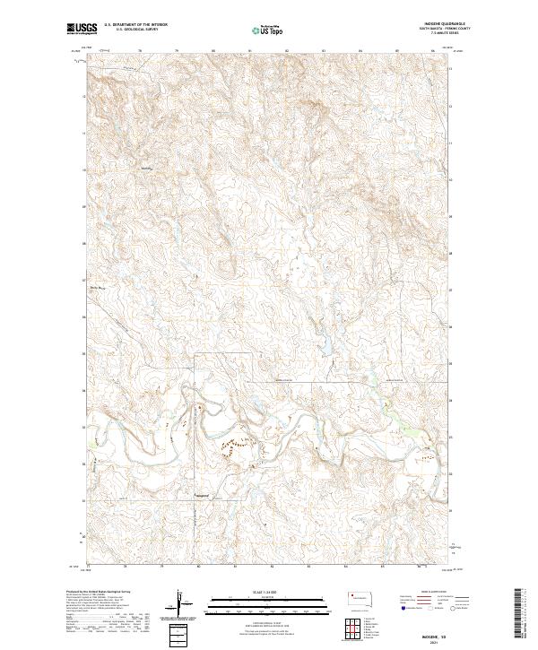
2021 Map of Imogene
USGS Topo · Published 2021About this map
Imogene sits as a quiet focal point in this Perkins County landscape, where the prairie is deeply etched by the winding course of the Moreau River. The terrain transitions from the open plains near 156th St to the more complex topography of the Badlands and Rocky Butte in the northwest. This 2021 survey reveals a remote ranching and grazing environment defined by an extensive network of watercourses, including Cottonwood Cr, Brushy Cr, and Cabin Cr, which feed the river system. Long-established routes like Moreau River Rd and Cedar Canyon Rd navigate the section lines of the Public Land Survey System, illustrating how human travel remains tethered to the natural draws and river bends of the western South Dakota plains.
Find a feature on this map
22 named features on this map. Tap any name to fly to it.
Don’t see what you’re looking for? This feature index may not catch every label — zoom into the map to look around manually.
Map Details
Editions of this 2021 Imogene Map
This is the sole edition of this map. No revisions or reprints were ever made.
Other maps of this area

1951 · Cedar Canyon
USGS Topo · 1:24,000

1951 · Maurine
USGS Topo · 1:24,000

1951 · Imogene
USGS Topo · 1:24,000

1951 · Bixby
USGS Topo · 1:24,000

1954 · Lemmon
USGS Topo · 1:250,000

1957 · Lemmon
USGS Topo · 1:250,000

1980 · Beverly Creek
USGS Topo · 1:25,000

1980 · Zeona
USGS Topo · 1:25,000

1983 · Rabbit Butte
USGS Topo · 1:24,000

1983 · Date
USGS Topo · 1:24,000