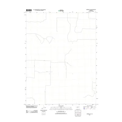
2011 Map of Imperial NE
USGS Topo · Published 2011About this map
Chase County's agricultural grid defines this western Nebraska landscape, where the High Plains terrain is etched by a network of rural section-line roads. The area is characterized by vast open spaces and ephemeral drainage patterns, with North-South corridors like 334 Ave and 335 Ave providing the primary transportation arteries between distant farmsteads. Unlike more densely settled regions, the infrastructure here reflects a modern era of large-scale land management, focusing on accessibility for irrigation and crop transport. East-West connections such as 749 Rd and 745 Rd link these corridors, maintaining a strict geometry across the prairie. This map offers a focused look at the rural spatial organization of the Nebraska panhandle region in the early twenty-first century.
Find a feature on this map
6 named features on this map. Tap any name to fly to it.
Don’t see what you’re looking for? This feature index may not catch every label — zoom into the map to look around manually.
Map Details
Editions of this 2011 Imperial NE Map
This is the sole edition of this map. No revisions or reprints were ever made.
Other maps of this area

1954 · McCook
USGS Topo · 1:250,000

1957 · McCook
USGS Topo · 1:250,000

1958 · McCook
USGS Topo · 1:250,000

1973 · Imperial NE
USGS Topo · 1:24,000

1973 · Imperial
USGS Topo · 1:24,000

1973 · Dittons Creek NW
USGS Topo · 1:24,000
1973 · Grant
USGS Topo · 1:24,000
1973 · Imperial NW
USGS Topo · 1:24,000
1973 · Elsie
USGS Topo · 1:24,000

1973 · Imperial Municipal Airport
USGS Topo · 1:24,000