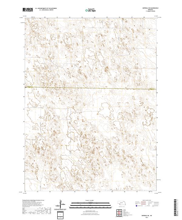
2021 Map of Imperial NE
USGS Topo · Published 2021About this map
The Perkins Co Chase Co line divides the landscape into a strict grid of section lines and gravel roads across these Nebraska plains. The terrain is defined by undulating hills and depressions, characteristic of the Sandhills region, where internal drainage patterns create a complex system of closed contours rather than defined stream beds. This 2021 survey by the U.S. Geological Survey shows a sparsely populated agricultural area where transport is limited to a network of county roads such as 334 Ave, 335 Ave, and 745 Rd. The land is neatly organized under the Public Land Survey System, with boundaries like t9n r38w and t9n r37w marking the townships. The absence of named towns or water bodies underscores the rural, open character of this high plains environment.
Find a feature on this map
16 named features on this map. Tap any name to fly to it.
Don’t see what you’re looking for? This feature index may not catch every label — zoom into the map to look around manually.
Map Details
Editions of this 2021 Imperial NE Map
This is the sole edition of this map. No revisions or reprints were ever made.
Other maps of this area

1954 · McCook
USGS Topo · 1:250,000

1957 · McCook
USGS Topo · 1:250,000

1958 · McCook
USGS Topo · 1:250,000

1973 · Imperial NE
USGS Topo · 1:24,000

1973 · Imperial
USGS Topo · 1:24,000

1973 · Dittons Creek NW
USGS Topo · 1:24,000
1973 · Grant
USGS Topo · 1:24,000
1973 · Imperial NW
USGS Topo · 1:24,000
1973 · Elsie
USGS Topo · 1:24,000

1973 · Imperial Municipal Airport
USGS Topo · 1:24,000