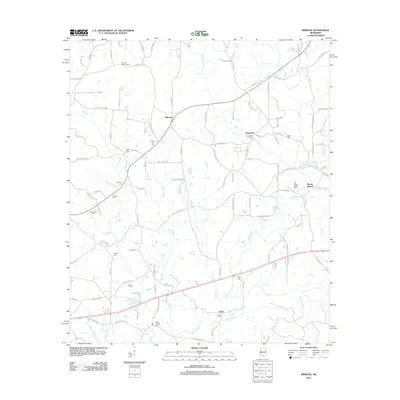
2012 Map of Improve
USGS Topo · Published 2012About this map
Improve and its surrounding rural communities in Lamar County are defined by a network of small family cemeteries and the industrial presence of the Improve Oil Field. The landscape is etched with numerous creek systems, including Upper Little Cr, Beaver Dam Cr, and Gully Cr, which flow through the pine-dotted terrain. This survey reflects a persistent rural pattern of settlement where life centers around local landmarks like the Improve Lookout Tower and a high density of burial grounds such as Enon Cem and Baylis Chapel Cem. The southeastern portion of the map identifies the community of Rocky Branch, situated near the confluence of Buckhalter Mill Cr and Hartfield Mill Cr, providing a detailed look at the region's hydrography and small-scale land divisions in the early twenty-first century.
Find a feature on this map
130 named features on this map. Tap any name to fly to it.
Don’t see what you’re looking for? This feature index may not catch every label — zoom into the map to look around manually.
Map Details
Editions of this 2012 Improve Map
This is the sole edition of this map. No revisions or reprints were ever made.
Other maps of this area

1953 · Hattiesburg
USGS Topo · 1:250,000

1958 · Hattiesburg
USGS Topo · 1:250,000

1969 · Baxterville NE
USGS Topo · 1:24,000

1969 · Pinebur
USGS Topo · 1:24,000

1970 · Columbia South
USGS Topo · 1:24,000

1970 · Bunker Hill
USGS Topo · 1:24,000

1970 · Columbia North
USGS Topo · 1:24,000

1974 · Sumrall
USGS Topo · 1:24,000

1974 · Oloh
USGS Topo · 1:24,000

1974 · Bassfield
USGS Topo · 1:24,000