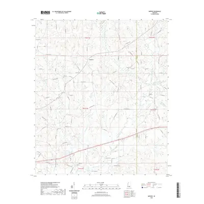
2020 Map of Improve
USGS Topo · Published 2020About this map
Improve sits at the heart of this landscape along the border of Lamar and Marion counties, serving as a central point for a network of rural roads and family-named landmarks. The area is defined by its numerous burial grounds, such as Watts Cem and Rose Hill Cem, which offer significant value for genealogical research in this part of Mississippi. The terrain is intricately carved by small waterways including Upper Little Cr, Beaver Dam Cr, and the Rocky Branch. Many of the roads, such as Old Sebe Watts Rd and W Baylis Chapel Rd, appear tied to the families and churches that established these communities. Notable historical markers like the Old Rocky Branch Cem and Baylis Chapel Cem indicate long-standing settlements that have persisted through generations of land use.
Find a feature on this map
97 named features on this map. Tap any name to fly to it.
Don’t see what you’re looking for? This feature index may not catch every label — zoom into the map to look around manually.
Map Details
Editions of this 2020 Improve Map
This is the sole edition of this map. No revisions or reprints were ever made.
Other maps of this area

1953 · Hattiesburg
USGS Topo · 1:250,000

1958 · Hattiesburg
USGS Topo · 1:250,000

1969 · Baxterville NE
USGS Topo · 1:24,000

1969 · Pinebur
USGS Topo · 1:24,000

1970 · Columbia South
USGS Topo · 1:24,000

1970 · Bunker Hill
USGS Topo · 1:24,000

1970 · Columbia North
USGS Topo · 1:24,000

1974 · Sumrall
USGS Topo · 1:24,000

1974 · Oloh
USGS Topo · 1:24,000

1974 · Bassfield
USGS Topo · 1:24,000