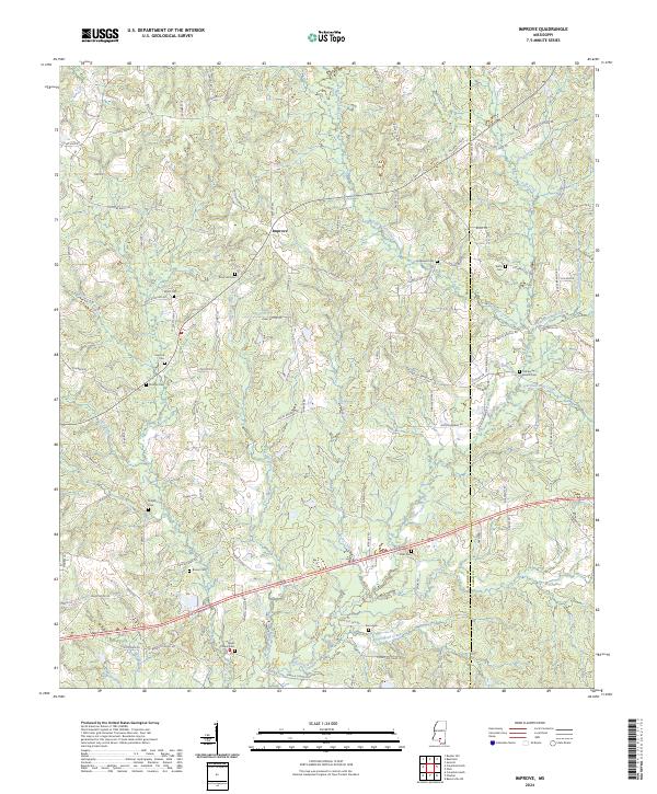
2024 Map of Improve
USGS Topo · Published 2024About this map
The community of Improve sits at the heart of this Southern Mississippi landscape, where the border of Marion and Lamar Counties follows natural and surveyed lines. The area is defined by a dense network of family-named cemeteries and rural churches, including the Baylis Chapel Cem and Rose Hill Cem, indicating a long-established pattern of dispersed agricultural settlement. The terrain is deeply etched by a complex drainage system, featuring notable watercourses such as Buckhalter Mill Creek, Hartfield Mill Creek, and Wolf Island Branch. These creeks and their tributaries carved the land long before modern roads like Improve Rd and Rocky Branch Rd connected the small farms and homesteads. The concentration of burial grounds, such as Hopewell Cem and Tolar Cem, provides a significant resource for tracing local family lineages in this corner of the state.
Find a feature on this map
112 named features on this map. Tap any name to fly to it.
Don’t see what you’re looking for? This feature index may not catch every label — zoom into the map to look around manually.
Map Details
Editions of this 2024 Improve Map
This is the sole edition of this map. No revisions or reprints were ever made.
Other maps of this area

1953 · Hattiesburg
USGS Topo · 1:250,000

1958 · Hattiesburg
USGS Topo · 1:250,000

1969 · Baxterville NE
USGS Topo · 1:24,000

1969 · Pinebur
USGS Topo · 1:24,000

1970 · Columbia South
USGS Topo · 1:24,000

1970 · Bunker Hill
USGS Topo · 1:24,000

1970 · Columbia North
USGS Topo · 1:24,000

1974 · Sumrall
USGS Topo · 1:24,000

1974 · Oloh
USGS Topo · 1:24,000

1974 · Bassfield
USGS Topo · 1:24,000