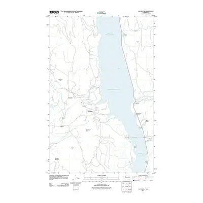
2011 Map of Inchelium
USGS Topo · Published 2011About this map
The settlement of Inchelium serves as a primary focal point on this 2011 survey, situated along the western shores of Franklin D Roosevelt Lake. This expansive reservoir on the Columbia River dominates the landscape, dividing Ferry and Stevens Counties. The local infrastructure reflects the importance of water transit, with both the Inchelium Ferry Landing and Gifford Ferry Landing providing a critical link for travelers on Gifford-Inchelium. In the surrounding highlands, the Colville Indian Subagency and the historical site of the Guinn Mine illustrate the intersection of tribal administration and mineral exploration.
Find a feature on this map
45 named features on this map. Tap any name to fly to it.
Don’t see what you’re looking for? This feature index may not catch every label — zoom into the map to look around manually.
Map Details
Editions of this 2011 Inchelium Map
This is the sole edition of this map. No revisions or reprints were ever made.
Other maps of this area

1948 · Hunters
USGS Topo · 1:62,500

1948 · Wilmont Creek
USGS Topo · 1:62,500

1950 · Wilmont Creek
USGS Topo · 1:62,500

1950 · Hunters
USGS Topo · 1:62,500

1950 · Inchelium
USGS Topo · 1:62,500

1952 · Twin Lakes
USGS Topo · 1:62,500

1954 · Okanogan
USGS Topo · 1:250,000

1956 · Wilmont Creek
USGS Topo · 1:62,500

1958 · Okanogan
USGS Topo · 1:250,000

1984 · Nespelem
USGS Topo · 1:100,000