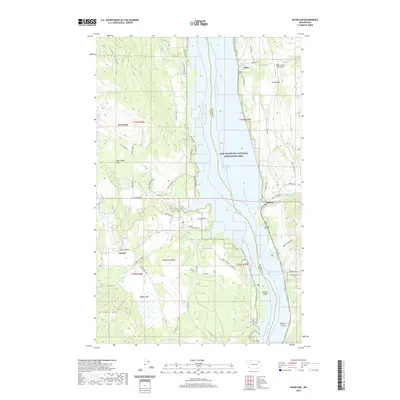
2020 Map of Inchelium
USGS Topo · Published 2020About this map
Inchelium and Impach occupy the western slopes above the Columbia River, which forms the primary boundary between Ferry Co and Stevens Co in this 2020 map. The river valley is dominated by the waters of Franklin D Roosevelt Lake, a central feature of the Lake Roosevelt National Recreation Area. On the eastern shore, the communities of Daisy and Gifford sit along the winding Miles Rd, connecting small settlements and landforms like Saints Flat and Bissell Flats.
Find a feature on this map
62 named features on this map. Tap any name to fly to it.
Don’t see what you’re looking for? This feature index may not catch every label — zoom into the map to look around manually.
Map Details
Editions of this 2020 Inchelium Map
This is the sole edition of this map. No revisions or reprints were ever made.
Other maps of this area

1948 · Hunters
USGS Topo · 1:62,500

1948 · Wilmont Creek
USGS Topo · 1:62,500

1950 · Wilmont Creek
USGS Topo · 1:62,500

1950 · Hunters
USGS Topo · 1:62,500

1950 · Inchelium
USGS Topo · 1:62,500

1952 · Twin Lakes
USGS Topo · 1:62,500

1954 · Okanogan
USGS Topo · 1:250,000

1956 · Wilmont Creek
USGS Topo · 1:62,500

1958 · Okanogan
USGS Topo · 1:250,000

1984 · Nespelem
USGS Topo · 1:100,000