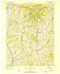
1955 Map of Independence
USGS Topo · Published 1956About this map
The community of Independence serves as a central hub for Kenton County in this mid-century survey, surrounded by a landscape of winding ridge roads and deep creek valleys. The area’s educational and religious foundations are well-documented, featuring the Simon Kenton High Sch and Kenton Elementary Sch, alongside numerous country churches such as New Banklick Ch and Hickory Grove Ch.
Find a feature on this map
58 named features on this map. Tap any name to fly to it.
Don’t see what you’re looking for? This feature index may not catch every label — zoom into the map to look around manually.
Map Details
Editions of this 1955 Independence Map
This is the sole edition of this map. No revisions or reprints were ever made.
Other maps of this area

1898 · East Cincinnati
USGS Topo · 1:62,500

1914 · East Cincinnati
USGS Topo · 1:62,500

1914 · West Cincinnati
USGS Topo · 1:62,500

1929 · Alexandria
USGS Topo · 1:48,000

1936 · Alexandria
USGS Topo · 1:62,500

1950 · Union
USGS Topo · 1:24,000

1950 · Independence
USGS Topo · 1:24,000

1950 · Verona
USGS Topo · 1:24,000

1950 · Walton
USGS Topo · 1:24,000

1950 · Covington
USGS Topo · 1:24,000