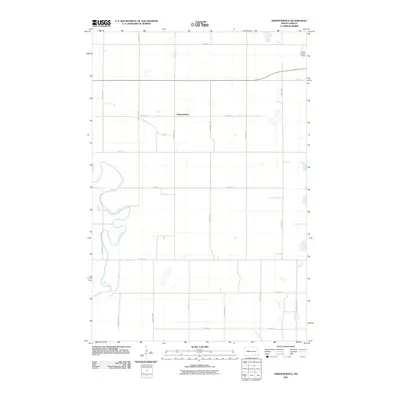
2011 Map of Independence
USGS Topo · Published 2011About this map
Independence sits at the heart of this North Dakota landscape, a settlement defined by a precise grid of rural section roads in LaMoure County. The meandering path of the James River cuts across the southwestern corner of the quadrangle, providing a sharp contrast to the geometric layout of agricultural tracts. This 2011 survey reflects the enduring spatial organization of the Great Plains, where long-established road names like 72nd St SE and 104th Ave SE mark the boundaries of farmsteads and fields. Beyond the primary settlement, the Laney Landing Strip in the northeast corner serves as a notable aviation landmark, indicating the importance of private flight in managing these expansive northern reaches. The map captures a moment of modern continuity in the rural Midwest, showing how drainage and topography still dictate the few deviations from the square-mile township system.
Find a feature on this map
17 named features on this map. Tap any name to fly to it.
Don’t see what you’re looking for? This feature index may not catch every label — zoom into the map to look around manually.
Map Details
Editions of this 2011 Independence Map
This is the sole edition of this map. No revisions or reprints were ever made.
Other maps of this area

1894 · La Moure
USGS Topo · 1:62,500

1894 · Fullerton
USGS Topo · 1:62,500

1894 · Oakes
USGS Topo · 1:62,500

1895 · Lamoure
USGS Topo · 1:125,000

1918 · La Moure
USGS Topo · 1:125,000

1952 · Glover
USGS Topo · 1:24,000

1952 · Oakes
USGS Topo · 1:24,000

1952 · Grand Rapids
USGS Topo · 1:24,000

1952 · Independence
USGS Topo · 1:24,000

1953 · Jamestown
USGS Topo · 1:250,000
Featured Places
- Ryan Township, ND
- Independence, ND
- James River Valley Township, ND
- Divide Township, ND
- Ovid Township, ND