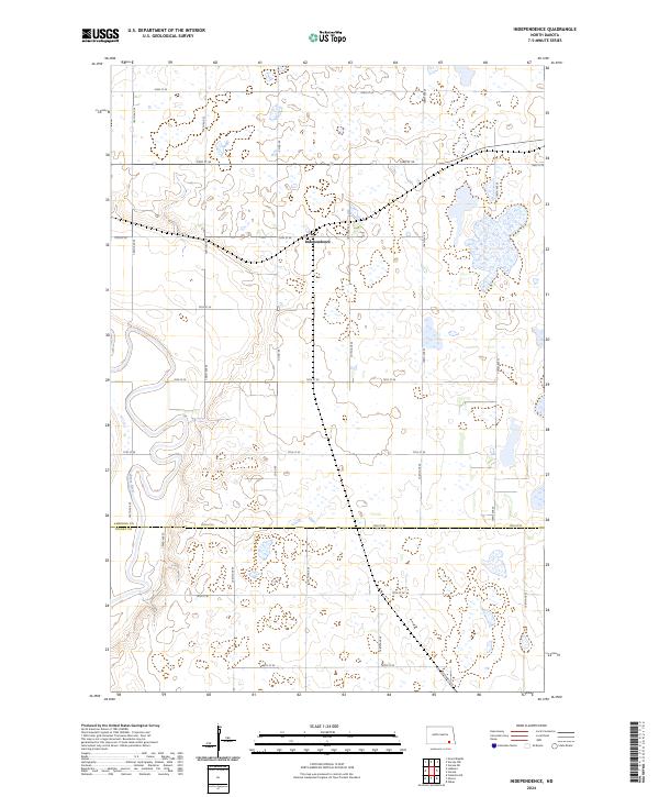
2024 Map of Independence
USGS Topo · Published 2024About this map
Independence sits at the heart of this prairie landscape, where the flat agricultural plains of North Dakota are interrupted by a dense network of wetlands and small basins. The southern portion of the sheet is marked by the border between LaMoure Co and Dickey Co, established along 78th St SE. The terrain is defined by its hydrography, specifically the winding course of the James River which cuts through the southwestern corner, creating a distinct riparian corridor amidst the surrounding section-line roads like Co Rd 60 and 105th Ave SE. Numerous parcels of the LaMoure County Waterfowl Production Area are scattered across the quadrangle, indicating a landscape managed for conservation and migratory habitat. This survey captures the intersection of high-plains farming and protected wetlands, preserved within the rigid grid of the Public Land Survey System.
Find a feature on this map
26 named features on this map. Tap any name to fly to it.
Don’t see what you’re looking for? This feature index may not catch every label — zoom into the map to look around manually.
Map Details
Editions of this 2024 Independence Map
This is the sole edition of this map. No revisions or reprints were ever made.
Other maps of this area

1894 · La Moure
USGS Topo · 1:62,500

1894 · Fullerton
USGS Topo · 1:62,500

1894 · Oakes
USGS Topo · 1:62,500

1895 · Lamoure
USGS Topo · 1:125,000

1918 · La Moure
USGS Topo · 1:125,000

1952 · Glover
USGS Topo · 1:24,000

1952 · Oakes
USGS Topo · 1:24,000

1952 · Grand Rapids
USGS Topo · 1:24,000

1952 · Independence
USGS Topo · 1:24,000

1953 · Jamestown
USGS Topo · 1:250,000
Featured Places
- Pearl Lake Township, ND
- James River Valley Township, ND
- Ovid Township, ND
- Greenville Township, ND
- Independence, ND