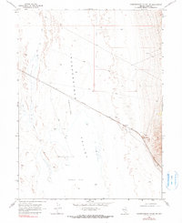
1968 Map of Independence Valley SW
USGS Topo · Published 1982About this map
Independence Valley (Depression) dominates this high-desert basin in Elko County, where the stark topography of the Alkali Flat meets the industrial trace of the Western Pacific railroad. Mapped in the late 1960s, the landscape reveals a transition from the broad, arid valley floor to the rising terrain near Rockland and Spruce. The presence of a Gravel Pit and a Corral indicates the dual reliance on resource extraction and ranching that shaped this part of Nevada. While much of the area is traversed by a network of Jeep Trails, the railroad remains the primary corridor of movement, cutting a straight line across the alkali-encrusted flats and connecting the remote settlements of the Great Basin to broader shipping networks.
Find a feature on this map
11 named features on this map. Tap any name to fly to it.
Don’t see what you’re looking for? This feature index may not catch every label — zoom into the map to look around manually.
Map Details
Editions of this 1968 Independence Valley SW Map
2 editions found
Other maps of this area

1953 · Spruce Mountain
USGS Topo · 1:62,500

1953 · Spruce Mountain 4
USGS Topo · 1:62,500

1955 · Elko
USGS Topo · 1:250,000

1958 · Elko
USGS Topo · 1:250,000

1962 · Elko
USGS Topo · 1:250,000

1965 · Elko
USGS Topo · 1:250,000

1968 · Independence Valley NE
USGS Topo · 1:24,000

1968 · Independence Valley SW
USGS Topo · 1:24,000

1968 · Ventosa
USGS Topo · 1:24,000
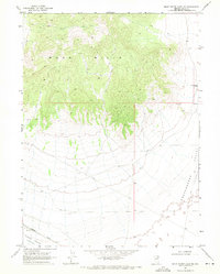
1968 · Snow Water Lake NE
USGS Topo · 1:24,000