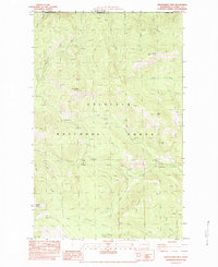
1983 Map of Independent Mtn
USGS Topo · Published 1983About this map
Colville National Forest dominates the terrain along the international border between the United States and Canada in Ferry County. This remote corner of Washington is defined by the sharp elevations of Huckleberry Ridge and a series of prominent peaks including Independent Mtn, Owl Mtn, and Jasper Mountain. The drainage patterns here are complex, with the North Fork, Middle Fork, and South Fork of unnamed drainages carving through the high country alongside Little Boulder Creek and East Deer Creek.
Find a feature on this map
34 named features on this map. Tap any name to fly to it.
Don’t see what you’re looking for? This feature index may not catch every label — zoom into the map to look around manually.
Map Details
Editions of this 1983 Independent Mtn Map
This is the sole edition of this map. No revisions or reprints were ever made.
Other maps of this area

1936 · Marcus
USGS Topo · 1:96,000

1942 · Marcus
USGS Topo · 1:125,000

1948 · Orient
USGS Topo · 1:62,500

1948 · Togo Mountain
USGS Topo · 1:62,500

1951 · Togo Mountain
USGS Topo · 1:62,500

1951 · Orient
USGS Topo · 1:62,500

1954 · Okanogan
USGS Topo · 1:250,000

1958 · Okanogan
USGS Topo · 1:250,000
1969 · Orient
USGS Topo · 1:24,000
1969 · Laurier
USGS Topo · 1:24,000