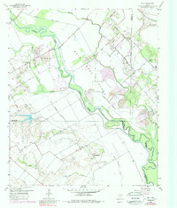
1959 Map of India
USGS Topo · Published 1988About this map
Bois D'Arc Island dominates the central landscape of this survey, a distinctive landform defined by the winding course of the Trinity River and the meandering Parsons Slough. The area sits at the intersection of Dallas, Kaufman, and Ellis Counties, showing a rural economy transitioning from traditional agriculture to industrial extraction. Numerous Gravel Pits are scattered across the terrain, particularly along the river basin and near Cottonwood Creek, indicating the importance of local material resources during this mid-century period.
Find a feature on this map
37 named features on this map. Tap any name to fly to it.
Don’t see what you’re looking for? This feature index may not catch every label — zoom into the map to look around manually.
Map Details
Editions of this 1959 India Map
4 editions found
Other maps of this area

1891 · Dallas
USGS Topo · 1:125,000

1893 · Dallas
USGS Topo · 1:125,000

1954 · Dallas
USGS Topo · 1:250,000

1956 · Ennis
USGS Topo · 1:62,500

1956 · Kaufman
USGS Topo · 1:62,500

1958 · Dallas
USGS Topo · 1:250,000

1958 · Hutchins
USGS Topo · 1:24,000

1959 · Seagoville
USGS Topo · 1:24,000

1959 · Ferris
USGS Topo · 1:24,000

1959 · India
USGS Topo · 1:24,000