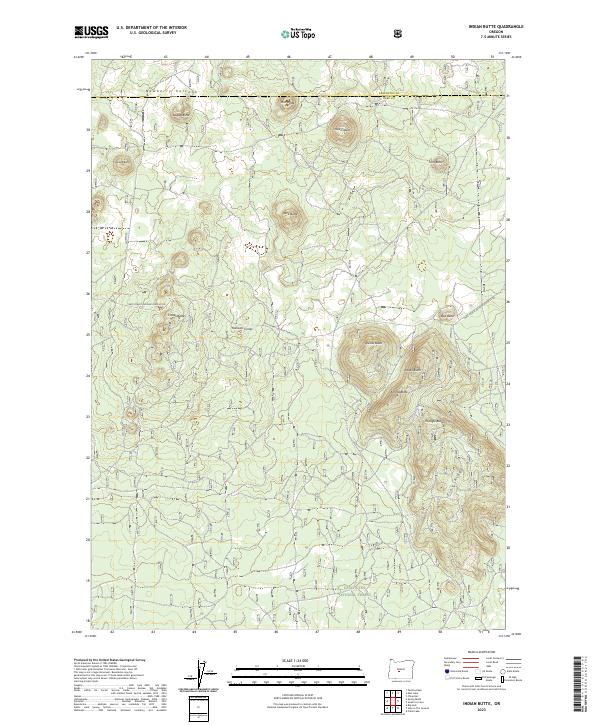
2023 Map of Indian Butte
USGS Topo · Published 2023About this map
Deschutes National Forest encompasses this volcanic terrain on the border of Lake and Deschutes counties. The landscape is defined by the southeastern reaches of the Newberry Volcano, characterized by a dense concentration of cinder cones and distinctive volcanic features. Significant landmarks like Indian Butte and the Hokisam Cones rise above the surrounding plateau, illustrating the area's complex eruptive history. The terrain is marked by numerous peaks including Willow Butte, Amota Butte, and Triangle Buttes, while Sugar Pine Ridge runs through the southeastern section. Human infrastructure is limited to the Natl Forest Develop Road 22 Rd, which provides access through this wilderness. This survey is essential for understanding the physical geography and geologic structure of this part of the Oregon high desert, where naming conventions often reflect local flora or indigenous terminology.
Find a feature on this map
24 named features on this map. Tap any name to fly to it.
Don’t see what you’re looking for? This feature index may not catch every label — zoom into the map to look around manually.
Map Details
Editions of this 2023 Indian Butte Map
This is the sole edition of this map. No revisions or reprints were ever made.
Other maps of this area

1931 · Newberry Crater
USGS Topo · 1:125,000

1935 · Newberry Crater
USGS Topo · 1:125,000

1955 · Crescent
USGS Topo · 1:250,000

1957 · Crescent
USGS Topo · 1:250,000

1958 · Crescent
USGS Topo · 1:250,000
1963 · Spring Butte
USGS Topo · 1:24,000
1963 · Paulina Peak
USGS Topo · 1:24,000

1970 · Crescent
USGS Topo · 1:250,000
1974 · Newberry Crater 4 NW
USGS Topo · 1:24,000

1979 · Crescent
USGS Topo · 1:100,000