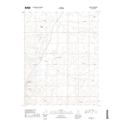
2018 Map of Indian Cove
USGS Topo · Published 2018About this map
Meadow Valley Wash defines the drainage and settlement patterns of this desert landscape, running through a series of canyons and flats in southeastern Nevada. The small communities of Bennett Springs, Beaverdam, and Indian Cove are clustered near this arterial watercourse and the adjacent highway, which provides the primary north-south transit corridor. To the west, the terrain rises into the steep recesses of Chief Canyon and Cobalt Canyon, while the eastern portion of the map is marked by broader features like the Miller Bench and the prominent ridge known as The Big Hogback. Local street names such as Sharon St, Mabel Trl, and Skyline Dr suggest more recent residential development near Bennett Springs, contrasting with the established rural routes like Beaver Dam Rd that connect the canyon floors to the higher desert plateaus.
Find a feature on this map
32 named features on this map. Tap any name to fly to it.
Don’t see what you’re looking for? This feature index may not catch every label — zoom into the map to look around manually.
Map Details
Editions of this 2018 Indian Cove Map
This is the sole edition of this map. No revisions or reprints were ever made.
Other maps of this area

1885 · Pioche
USGS Topo · 1:250,000

1886 · Pioche
USGS Topo · 1:250,000

1916 · Highland
USGS Topo · 1:62,500

1918 · Highland
USGS Topo · 1:62,500

1921 · NW 1/4 Panaca
USGS Topo · 1:48,000

1954 · Caliente
USGS Topo · 1:250,000

1959 · Caliente
USGS Topo · 1:250,000
1970 · Bennett Pass
USGS Topo · 1:24,000
1970 · Caliente
USGS Topo · 1:24,000
1970 · Panaca
USGS Topo · 1:24,000